Tag Archives: alaska

Alaska: Ketchikan (Days 3-4) and Home

25 Jul

The third day that we were in Ketchikan happened to be the Fourth of July so while Al and Matthew got up early to go fishing, the rest of us slept in and then we made our way downtown for the parade which started at noon.

The stair streets continued to amaze me.


Travis had to take his turn as the pirate since he wasn’t with us the other day:

Since we had time to kill before the parade, we did some more shopping and posing.

Travis’ mom is awesome.

Al, Matthew, Kurt and Marlene met us in front of the fire station to watch the parade. It started with a helicopter flying with the American flag.

I was amazed at all of the groups in the parade. Since I grew up in a big city (80,000 people), I’m always surprised at any signs of “civilization” small towns have (though Ketchikan probably isn’t considered small at 14,000 people). Travis is helping to rid me of my big-city prejudices.

They raced rubber duckies in the water by Creek Street as a fundraiser, which was a fun idea (and a fun float!).

After the parade, we ate the sandwiches we brought along and then walked around Creek Street (since the guys had been fishing when we went before). We saw a trolley…

…and a fish ladder, which helps salmon run the river without going through the rapids.

Since we were downtown, we decided to check out the Discovery Center, which we had heard was pretty interesting. We found out that since it was a national holiday, admission was free. Can’t beat that!

We saw baby salmon:

Lots of stuff about the natives and the industries that built Alaska into what it is today:


Learned about the core samples we had found on our hike to Lower Silvis Lake:


And I think this is interesting – Alaska is so big that it would stretch across the Lower 48.

After all of our discoveries, we walked back to the apartment. For dinner, we went to a BBQ hosted by some of Kurt and Marlene’s friends. We brought burgers and drinks and they provided quite the spread. I filled up on all kinds of jello salad before my burger was even done because I decided I’d rather eat jello salad than a burger (though I did end up eating my entire burger too). Alaska reminds me in many ways of Minnesota – the greenery, the snow (in some parts), the bugs, the nice people, the jello salads. Everything except for the ocean and mountains. Minnesota doesn’t have those. Although the ocean has been mistaken for big lakes by several people (Minnesotans)…

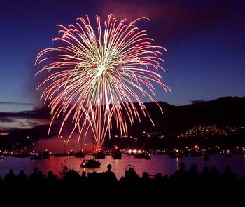
Around 9, we headed back to the apartment to watch the fireworks, which wouldn’t be shot off until 11 pm. We had planned to walk down to the main street again but the fireworks started just as we were leaving and we discovered that we could see them fine about 200 feet from our front door. So we just stood in the street to watch them. It was a very good show for a small town. 😉 The loud ones would create an echo that bounced off all the mountains around us. Very cool. I love fireworks. And I love being able to walk only 200 feet before I’m home and can go to bed. No traffic fighting for us!

The next day was our last day in Ketchikan. And it was absolutely gorgeous. The sun was shining, the clouds were sparse and Deer Mountain was asking to be climbed. So climb it we did.

Since it’s a fairly strenuous hike (3,000 feet elevation gain in 2.5 miles), Al and Beth opted to do a different hike. So it was just the four of us younguns. For the first 2 miles, it felt like we were in a jungle.


So many stairs.

An idea of how fast it climbed:

This is called Devils Club. Why?

Because of these guys:

The first overlook had awesome views of the ocean.


As we continued on, we came across a place where a mudslide or avalanche must have happened.


Right before the second scenic overlook, we started encountering snow.


And more beautiful views. Now we were really getting up there.


Even though the rest of the way to the top was all snow, we decided to continue on (although if we had known what we know now, we probably would’ve turned around.)


It was so steep and slippery that we pretty much scrambled up on all fours.

With extremely short walking sticks.

The views were breathtaking.

I was trying my best to focus on putting one foot in front of the other, instead of freaking out about how high we were and how steep it was.

We got to a point, though, where it was so steep that we weren’t sure how we’d get back down. So Matthew, Drew and I stopped about 400 feet from the top, while Travis continued on and disappeared over the top of the ridge.

I distracted myself from the fear of Travis dying by taking pictures.

Yes, I know I look ridiculous but the bugs up there were HORRIBLE. It has been almost 3 weeks since this hike and I still have a bug bite on my arm. And I hate bugs. Hate. Hate. Hate.

Finally, Travis’ head poked back over the top.

Thank God he’s alive!

Then the fun part began – shoe skiing! When you get a running start on snow like this, you can just slide down on your shoes. It’s a little tricky and I fell more than once but it was a lot of fun. And a lot of cold.

When we got past the snow, Travis was able to actually wring water out of his socks, they were so wet. But we lived to tell our tale! (Later that night, we found out that people die on Deer Mountain every year because of unpredictable avalanches. Ha… glad I didn’t find that out the hard way.)

So the sun does still exist.

After our hike, the guys showered up while Al, Beth and I ran a few errands. Then we ate dinner (tortellini, garlic bread and salad) before heading over to Kurt and Marlene’s for a bonfire and s’mores. Around 10, we said our goodbyes, drove back to the apartment, finished packing as much as we could and went to bed.

Our flights back home on Friday went without incident. Travis and I got back to our house in Denver by 6 pm, just in time to pick our dogs up from doggie daycare. Home sweet home for all of us!

So was Alaska everything I thought it would be?

Yes!! It was an awesome vacation and I loved that we got to do a lot of hiking and sightseeing. Renting an RV was a great idea – it was so nice to not have to deal with lugging our stuff into hotels, not worrying about where to stay or having to sleep in less-than-ideal hotel rooms. Obviously, it was also a huge blessing to have awesome friends in Ketchikan who were willing to show us around, cook us amazing food and spoil us. But it would be a fun place to visit even if you didn’t have those connections. And since it hadn’t rained in Colorado for months, the rain every day didn’t bother us. I would definitely recommend visiting Alaska to anyone who likes the outdoors!


Alaska: Ketchikan (Days 2-3)

23 Jul

Our second day in Ketchikan, Travis, Matthew and Al went fishing with Kurt pretty much all day. So Beth, Drew and I had a lazy morning, then walked to the shops in downtown.

Drew refused to take a picture as a pirate. He retorted, “I don’t do that in public.”

I was so fascinated by the named streets that were really just staircases that I took a picture of this “intersection” two days in a row:

The cruise ships are HUGE.

And you could definitely tell who was a tourist (dressed up, wearing heels) and who was a local (wearing jeans and Ketchikan sneakers). We were kind of in-between because our plans had been to be at a cabin all week so we only brought jeans and sweatshirts along.

Creek Street was the old red light district. While I like historic things, brothels are not one of them, so we declined that tour. (The rest of Creek Street is now just local shops.)

By the time we were done shopping, we were ready for lunch so we headed back to the apartment. The fishermen stopped by for about 5 minutes and when I discovered they were going back out fishing, I got a little angry at Travis. But I got over it and our group of 3 decided to ride the city bus out to Totem Bight State Park, which went smoothly with not a single incident. But on the way back, our bus driver stopped at the gas station to fill the bus up. That was a first.

The volunteer working in the visitor center was just closing up for the day and was in a very good mood so she let us in to the building where they were ‘rehabilitating’ some old totems that were rotting.

It was a lot easier to look at them when they were laying down (otherwise, some of them are so tall you just about fall over following them to the top).

Then we continued on to look at the clan house on-site, which was interesting. The natives lived in houses like this in clans of 45-50 people during the winter. In the summer, they set up camps near wherever they were fishing.

We of course saw more totems, but they’re not as cool in pictures as they are in real life, so I’ll spare you. It was low tide at the time so we walked out on to the exposed seaweed and looked for hermit crabs.

While we waited for the bus, Drew played with something I haven’t seen in over a decade.

I asked him if he knew what that even was. He did. Smartypants.

We got back to the apartment around 6 and since we had no idea when the guys were coming back, we made dinner when we started feeling hungry. Beth and I (but mostly Beth) put together beautiful homemade pizzas. About 10 minutes later, they were burnt to a crisp. Apparently, the oven temperature was not accurate. We were able to salvage them though – just the cheese was burnt so we peeled that off, put on more cheese and put them back in the oven, checking them every minute. So we had pizza for dinner and it was still pretty tasty. The guys came back not long after that and after they ate, we all went to bed.

The next day, the guys weren’t going fishing until the afternoon so we all went on a hike up to Lower Silvis Lake. It was 5 miles round trip and gained about 800 feet so while the climb wasn’t crazy steep, it was constant. All up on the way out, all down on the way back.

The guys saw the tunnel around the big pipe and just had to walk through it. I refused because of the spider-danger. Nothing is worth encountering spiders.

Being the almost-teenager boy that he was, Drew had to try climbing everything.

Even if it meant he could barely get down.

(He survived.)

We got up to a dam and had to climb over the fence to check it out.

Water, water everywhere.

We also came across a big pile of granite core samples.

We contemplated bringing them home for a new kitchen countertop but decided against it.

Finally, we reached the lake.

The bugs were so bad there though that I literally kept pacing back and forth until we were ready to turn back. Travis decided to imitate Ace Ventura and walk the ledge.

Then the guys went out fishing.

The rest of us hung out with Marlene, talking and drinking. Being around Drew reminds me of how much I hated adult conversation when I was his age. Talking seemed like The Worst way to spend your time. Now, I honestly enjoy it. I guess that makes me an adult, huh?

We played some Phase 10 as well until the guys got back and had gutted their fish. Then we had dinner: salmon chowder. Yum. So delicious. I can’t wait until we get some of the salmon Travis caught from his parents because I will be making this! After dessert of mint brownies and ice cream again, we called it a day.

Only one post of Alaska left… don’t be so excited. 😉

Alaska: Ferry and Ketchikan (Day 1)

22 Jul

We got on the ferry around 6 pm on Friday, June 29. We wouldn’t be getting off until 6 am on Sunday, July 1. Yes, the ferry ride was 36 hours long.

We had reserved a 4-person berth, which was nice because it gave us a secure place to put all of our crap, and I was able to go to bed at 7:30 that night. Seriously. We ate our pizza up on the top deck under the Solarium and then I tried to hang out in the observation deck but was too sleepy. So I went to “take a nap” but didn’t get up before morning. Apparently, I was tired!

The Solarium

Our ship’s name

The map of the ship

At first, the ship seemed huge. But after being on there just a few hours, you pretty much knew where everything was (at least, what was accessible to the passengers).

To be completely honest, I got a little bored on the ferry. There’s only so much watching and waiting for wildlife, reading and crosswording, hanging out and napping I can do. We stopped at 4 different ports before getting to Ketchikan: Sitka, Kake, Petersburg and Wrangell. We stopped at Sitka in the middle of the night but got off for 20 minutes at Kake the next day, walked to the only store within walking distance and bought some ice cream.

The stops at Petersburg and Wrangell happened while we were awake but they were only for about 20 minutes and we didn’t think it was worth it to get off, only to get right back on.

Finally, we were coming in to Ketchikan. It’s very cool to watch how they get the ship tied to the dock in the right place. They winch it in. (The pics below are from 2 different ports, if you’re confused about why the dock is on one side in some and on the other side in others.)

We got off the ship, walked across the street for some blessed coffee and waited for our ride in the Alaska Marine Highway building. (I was reading blogs on my phone for the first time since getting to Alaska.)

Have I mentioned that Al and Beth (and Travis and his sister Carolyn) used to live in Ketchikan? Al and Beth moved there when they were first married, stayed for about 8 before moving back to MN and haven’t returned for about 25 years. I think they enjoyed seeing their old stomping grounds.

They still have some friends who live there – Kurt and Marlene. They were so nice and accommodating to us! They let us stay for free in an apartment they own that doesn’t have any renters currently. They borrowed us a car for free. And they invited us over to their house 3 nights out of the 5 we were there.

After Kurt picked us up, we went grocery shopping, napped and then drove around town to see some of the schools Travis went to and apartments they lived in. One of those apartments was actually just at the end of the street a couple hundred feet from the apartment we were staying in.

The streets in Ketchikan are crazy steep and narrow. The street our apartment was on was so narrow that you had to back out of it – no room to turn around! And the steepness reminded me of San Francisco. They have named streets that are just stairs, which I’ll talk more about in a different post. I remarked “Wow, I bet this is horrible in the winter” and was told that it doesn’t really snow in Ketchikan, and when it does, it melts pretty quickly because they get 160 inches of rain a year. Ketchikan is literally in a temperate rainforest (as opposed to a tropical rainforest).

Look at the moss on the back of this roof (the apartment at the bottom was the one they lived in):

Near our apartment was also a float plane harbor, which had planes flying in and out as early as 7 am everyday (grrr):

We tried to go tour the fish hatchery and native museum but you had to pay for them now (not 25 years ago!) so we ended up just walking around in the rain for a while.

Then we went to the Saxman Native Village to see the world’s largest collection of totems.

We learned what most of the symbols mean but I’m not going to tell you because 1) I’ve already forgotten and 2) they never made a ton of sense in the first place. I need an expert to interpret the poles for me.

After driving to the end of the southbound road (there are only about 20 miles of road in Ketchikan because it’s on an island), we went over to Kurt and Marlene’s house. Their two daughters and son-in-law were there too so we were a big group! We finally ate some wild salmon worth writing on the blog about! The locals know how to do it right. It was awesome. We also had carrots coated with pecan Nut-Thins and sour cream (I think… regardless, they were delicious, trust me) and baked potatoes. For dessert, we had mint brownies and ice cream and were informed at the end of the meal that everything had been gluten-free (their son-in-law has celiac). I was impressed – nothing tasted GF!

After we were thoroughly stuffed, we played some Phase 10 until about 10:45, and then went home to bed. There was fishing to be done the next day!

Coming up: Ketchikan Days 2 and 3


Alaska: Seward (Day 2) and Juneau

21 Jul

The morning after our Kenai Fjords Tour (our second day in Seward), we got up around 8, ate breakfast and took showers. We left the RV park and drove to Lowell Point, for a hike to Tonsina Point that you could only do at low tide.

The first part of the hike was pretty, though it was just on a gravel road.

But then the trail narrowed and we crossed a stream or two.

As we continued on, we encountered a lot of plank bridges covered with nets, to keep them from being incredibly slippery in the constant dampness.

We also crossed a lot of bridges.

Even though it was cloudy and rainy, the views were still beautiful.

The trees covered in moss reminded me of something out of a Dr. Seuss book.

Finally, we made it out to the beach.

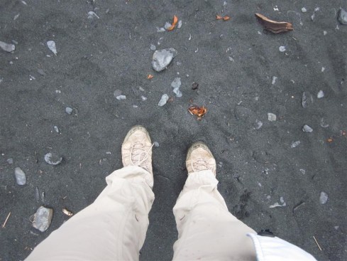
The sand is black because of the high concentration of mineral sediment from the surrounding bedrock, which is also black. It looks cool, no?

We were there at low tide so we could walk out a long way.

Barnacles!

After hanging out at the beach for a while skipping rocks and looking at the flat rocks (like the ones we saw on Fox Island), black sand and kelp, it started raining pretty good and we were getting hungry. So we decided to head back. Travis and Drew walked along the beach instead of following the trail back. By the time they reached the RV, their feet and pants were soaked.

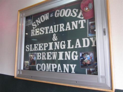
We ate lunch and then got on the road back up to Anchorage. We ate dinner with our friends, A & L, who are in Anchorage doing traveling nursing, at the Snow Goose Restaurant in downtown Anchorage.

The food was decent but nothing to write home a blog about.

We were flying to Juneau early the next morning so we parked and slept at the RV rental place, since it was close to the airport. The next morning, Travis drove all of us and our luggage to the airport, then drove the RV back to the rental place and literally ran back to the airport.

Our flight to Juneau was short and uneventful. We were greeted by typical summer weather in Alaska: 50s and rainy. We rented a sweeto minivan from a company called Rent a Wreck (seriously) and drove to downtown Juneau.

We did some shopping – I bought some Glacier Silt Soap, which is made with the sediment in glacier runoff. It smells amazing, makes your hands really soft (and not filmy like regular bar soap), and it’s made and sold only in Juneau!

Then we took a tour of the capitol. It’s a pretty humble building – no dome – because it was built as a federal building and not a capitol. And it’s not they have a ton of room to build a completely new one, since the town is right on the ocean.

After the tour, we walked over to a historic Russian Orthodoxy Catholic church.

It was interesting, and the smallest church I have ever seen.

We walked back to the main strip and ate lunch at the Red Dog Saloon. It had a cool atmosphere, similar to the Old West feeling. I had the fish and chips and they were pretty good.

After lunch, we drove around the island and Juneau, and saw the Mendenhall Glacier from afar.

Then we bought some pizza to eat on the ferry and headed to the boarding area.

Coming up: Alaska Marine Highway and Ketchikan

Alaska: Seward (Day 1)

20 Jul

If you missed my first two posts on Alaska, here are the links to the marathon recap and our adventures in Talkeetna/Denali.

On the morning of Day 6, we took showers at the Big Bear RV Park (which were very nice btw), ate breakfast, and got on the road. I sat in the front of the RV with Travis as his co-pilot, which was nice because I could really see where we were going (otherwise, in the back, you can only look out the side windows or you have to ride hunched over to see out the windshield.)

We stopped by the RV rental place on our way through Anchorage and got a new air mattress, which we liked a lot better. The inflator machine also ran on batteries instead of electricity, so we didn’t have to fire up the generator every night, which was nice.

Finally, we were on our way to Seward. The drive was beautiful.


We stopped at several scenic overlooks and wildlife viewing sites.


Everyone looking at Dall sheep on the distant mountainside

We ate lunch on the way and arrived at our RV site by mid-afternoon.


After checking in, we had plenty of daylight left to go check out Exit Glacier.


That sign was where the glacier reached in 1951. It’s receding fast!

Here’s why the glacier looks blue (I won’t tell you myself since I’ve been saying it backwards whenever I explain it):

We grilled up hamburgers and potatoes for dinner when we got back. Then, while Beth went to do laundry, the rest of us played several intense rounds of Gin Rummy and Trav’s dad, Al, got caught cheating.

The next morning (Day 6), we got up early for our Kenai Fjords Tour.

We didn’t know this before arriving at the RV Park but Kenai Fjords Tours has free shuttles that run to several of the local RV parks. Just thought I’d tell you in case you’re planning a trip to Alaska after reading all these posts. 😉

The Seward Harbor was really cool. I can’t get over how awesome mountains + ocean is.

Our ship was the Nunatak.

It got cold on the boat!

The first wildlife we saw were sea otters, just chilling right in the middle of the wide open sea.

Silly otters.

Then we saw a couple of humpback whales, which was very cool. You can just barely see the whale fluke in the bottom left of this picture.

Then we got closer.

It was a mommy and a baby!

The landscape and water were so pretty too. Such a change from all of the sediment-y glacier runoff we’d been seeing.

It was nice and warm in the back of the boat, and with standing in front of the heat exchange but the diesel fumes started to make me sick so I had to go back up to the top deck after a while.

I love how the sky and ocean are almost the same color in this picture:

The next wildlife we saw was a group of Killer whales (maybe 5-6). They never surfaced at the same time but it was cool to see so many in one spot.

We also encountered some stryofoam that had washed over all the way from Japan (aftermath of the tsunami).

They tried to spear it but it was too big.

All this time, we were making our way over to the Aialik Glacier. It was massive.

For a point of reference:

That ship was the same size as the one we were on. The glacier is something like 400 feet tall and breaks off into the ocean by as much as 20 feet per day. We could hear the ice heave and pop, and we even got to watch some of it break off:

It was very cool. Literally.

Matthew with some glacier ice

Way more awesome (and bigger) than the Exit Glacier.

We set off again and before long, we saw a whole bunch of puffins and seagulls on appropriately named ‘Gull Island.’

So many birds.

The sun poked its head out of the clouds for a bit, which was very welcome.

We saw some sea lions sunning themselves.

In these pictures, it looks like mid-day but it was actually almost 5 pm! We got off on Fox Island (which only Kenai Fjords Tours’ customers get to do) and ate a dinner of salmon and prime rib. I didn’t have any prime rib (ew) and the salmon was a little dry and disappointing. But the boys got some good rock skipping in with the flat, oval rocks that made up the beach.

And then it was back to port and to our RV park. We picked up some drinks at the liquor store (for those who were old enough) and attempted to have a campfire. But wood was scarce and wet, and it started to rain a bit so we threw in the towel and went to bed.

Well, this post has gotten quite long! Between this tour and the one in Denali, I’m pretty sure I took about 400 pictures. So I will write about our second day in Seward in another post…

Alaska: Talkeetna and Denali

9 Jul

Hi friends! I’m back. Alaska was wonderful and so much fun but it’s good to be home. Now that we’re all unpacked with clean laundry and food in the fridge, I can tell you about our Alaskan adventures.

You’ve already heard about how the marathon went. 

After the race, we went and picked up our RV.

{at our first campsite}

We weren’t able to get a late checkout from our hotel so Travis and I ended up showering at the RV place. A little strange but it worked. After lunch at The Village Inn, we went grocery shopping (we cooked all of our own meals, except 3-4 that we had to eat out) and then headed north on our way to Denali.

We made it as far as Talkeetna and then settled in for the night at the campsite above. It wasn’t the most appealing campsite ever but we didn’t really mind as we were all exhausted from traveling and a long day in the RV (and me, running a marathon!).

Right away that first night, we realized how weird it was to have so much daylight. It’d be 11 at night and you’d think it was 5 because of all the daylight. Even when we went to bed at 10:30, it was bright outside, and whatever time we got up, it was light outside (it gets dark around 11:30 and light around 4 that far north). We ended up making a sunlight blind from a beer box for the upper bunk of the RV.

The next morning, we walked over to check out the small town of Talkeetna.

The water is so dirty because it’s glacial runoff and is full of silt. (I actually bought some soap in Juneau made with glacial silt and it’s amazing! It makes your hands feel so soft.)

After touring the town and doing a little shopping, we walked back to our RV and got on the road. We stopped frequently to take pictures and see the sights on our way up to Denali because 1) we had nowhere to be and 2) the mountains were gorgeous.

We stopped at the Veteran’s Memorial.

Saw Hurricane Gulch, which is pretty impressive.

After a very bumpy RV ride, we finally made it to Denali National Park.

We went to the Visitor’s Center, then ate dinner and fixed the air mattress that Travis and I were sleeping on (it had gone flat the night before!). After that, we took advantage of our copious amounts of daylight at 9:30 pm to go on a walk down to Riley Creek.

{Check out the giant blister on the inside of my right big toe!}

The next morning, we got up early for the 7 am Eielson Tour into the park.


{From left to right, Travis, Drew (our nephew), Matthew (T”s bro), Al (T’s dad), Beth (T’s mom), and me}

The first animals we saw were some caribou (reindeer) down by the water. They were pretty far away so you needed binoculars and a mega-scope on your camera to see them well.

And then 3 different times, we saw a momma brown/grizzly bear and her 2 cubs (at least 2 different sets, if not all 3). They were SO cute! The little cubs were bumbling along and playing with each other. It was very cool. They only have about 600 bears in the entire 6 million acre park, so seeing that many was really special.

We stopped a couple of times along the way (it takes 4 hours to get up to the Eielson Visitor Center – it’s 66 miles into the park). You’re allowed to hike around and get on another bus if you want but there aren’t any trails (you’d have to just bush whack) and it seemed fairly involved to get on a different bus. So we just stayed on our own the whole way. Our driver was really funny and knowledgeable too so it was an enjoyable drive.

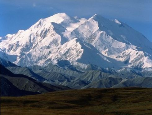
Finally, we got up to the visitor center. It had been a sunny, warm day when we started out on the trip into the park but the closer we got to the mountain, the cloudier and colder it got. Apparently, Denali is big enough that it creates it own weather and when the sun melts the snow, it creates a lot of clouds and hides the mountain. All we could see up at the visitor center was fog (which is normally where you get the best view of the mountain).

On the way back, we were all tired and struggled to stay awake. We saw some more bears, eagles, a marmot, some more caribou and then we were back to where we started.

We had already “checked out” of our campsite so when we got back to the RV, we hit the road back toward Anchorage. For the night, we stayed at the Big Bear RV Park in Palmer (near Wasilla).

We finally had a campfire! Every other place we had been were selling little bundles of firewood for $10. This place had a bargain of $6 a bundle. Having a fire was a little weird though because it was completely light outside.

And that was the end of Day 4!

Coming up: Seward (whales!), Juneau and the ferry

Race Recap: Mayor’s Marathon

25 Jun

{Sorry for the late update/recap – we’ve been in The Last Frontier with no wi-fi!}

Travel on Friday to Anchorage was a debacle – our 6:30 am flight to SLC got delayed enough that we would miss our connection to Anchorage. After spending an hour investigating options, the best choice was to instead fly to Minneapolis at 11:35 am, have a layover until 3 pm, then fly 5.5 hours to Anchorage, getting in there at 6 pm (Alaska is 1 hour behind Pacific Time) – meaning a 15 hour travel day for us. Travis’ parents were able to pick up my race packet, so everything ended up working out fine. Just not my choice of how to spend the day before the race.

Once we got in, we dropped our stuff off at the hotel, ate dinner at an Alaskan restaurant called Gwennie’s, and then passed out in our hotel room.

……………………

My alarm went off at 5:30 am and I popped out of bed. I had actually slept pretty well – I woke up quite a bit throughout the night but was able to get back to sleep quickly without lying awake panicking.

I slathered on Body Glide (not enough apparently because I got major sports bra chafe);  put on my 2XU compression tights, running skirt, new REI shirt, and 2 sports bras; taped my big toes; got my race bag together; packed my stuff; did my hair and makeup (just mascara and a little powder); and then went down to breakfast.

Everyone (Travis’ parents, brother and nephew, along with Travis) was up to see me start! I had coffee and water and buttered a plain bagel to eat closer to the race start. We drove over to the race start and got there at 7:00 – plenty of time before the race started at 8. I used the portapoo, stretched, took some pics, ate my bagel, found some Tums, and then used the portapoo again.

During this time, I was feeling relieved that race morning was finally here (no more worrying and wondering!) and excited – I was about to run a marathon! It was also the perfect day weather-wise: sunny, mid-70s, no rain. A gorgeous day. Finally, it was time to line up.

They played an Alaskan song, the National Anthem and then the mayor spoke. And then it was time to go! Travis and his family snapped some pics of me as I ran by and then I was lost in the sea of runners. There were about 1,000 runners again this year – from 48 states, 16 countries and a record number of Alaskan runners.

I tried to ignore the pace of the runners around me and just run what felt right to me. My legs felt good but the sun was hot – I could tell that it would get pretty warm out on the course. I had my Garmin set to show the average pace of my entire run and when I saw 11:20 for my first mile, I decided that even though it was faster than I said I would run, I didn’t feel like I was going out too fast. By Mile 3, my average pace was around 11:33, where it stayed for almost the entire race.

1 – 11:21

2 – 11:21

3 – 11:45

The first aid station was around Mile 2 and I grabbed a cup of water, stopped to drink it and then kept running – which was what I did at every aid station, although around Mile 10, I started grabbing 2 cups of water and an orange slice every time. I was So. Thirsty. There were times when I wished I had my Camelbak and didn’t have to wait until aid stations for water and then chug down 2 cups at a time. But overall, I think it was worth it to not have that extra weight/annoyance to deal with.

The first 4 miles, we ran along the busy highway, which wasn’t the most enjoyable but it had a nice view of the mountains. Then we crossed over the highway and got on to a county road, which was paved and rolling hills. I was very encouraged during the first 5 miles of the race – the hills that I had seen on the elevation map weren’t challenging to me at all! I sailed up almost every single one of the hills – there were maybe 2 in the entire race that I had to slow down to run up and got to the top breathing heavily but I didn’t have to walk any hill (except at the very end but even flat road was a challenge then!).

4 – 11:45

5 – 11:22

I ate my first packet of Honey Stingers at Mile 5, which is also when I started my iPod. Travis was going to join me for Miles 9 – 13, so I planned to listen to my iPod until he joined me. Well, it had other plans. Around Mile 7.5, it froze. The screen was on but it wasn’t playing music. I took off my headphones, stashed them in the pouch, and gave it up for dead (I handed it to Travis’ brother when I saw them at Mile 9).

After the rolling hills on the county road, we ran past a golf course and then got on the Oilwell Tank Trail, which was where Travis joined me. This was the gravel road that stretched from roughly Miles 7 – 14. I had been slightly apprehensive before the race about this portion because of reading about “baseball size rocks” and the possibility of twisting an ankle. And I’ll say – they’re not lying. There are some very decent size rocks out there and it was not at all like a well-maintained gravel walking/hiking trail. It was a gravel road. But I had known it was coming and I knew when it would end, so I didn’t mind it for the most part, though it was kind of rough on the feet.

6 – 11:44

7 – 11:32

8 – 11:13

9 – 11:34

There were a few steep hills on this part of the trail but we muscled up them. Travis peeled off at Mile 13 and I continued on.

10 – 11:41

11 – 12:14

12 – 11:18

13 – 11:26

Around Mile 14, though, we were funneled onto a single-track hiking path – like a true trail run! I was absolutely thrilled at this discovery. It was a lot easier to run on than the gravel, but we were running through the woods and even had to cross a couple of streams (on small bridges)! I was in heaven. I kept thinking, “This is freakin’ awesome!” Even though that part of the trail was the peak of the course elevation, it was less steep than previous parts. I kept running, though almost everyone else around me was walking.

14 – 12:07

Still on the trail, we started going back down. I felt great so I ran it at a strong pace and kept going when we got back out onto pavement around Mile 15. We kept going down for Miles 16 and 17. These were my fastest miles of the race. I knew that I still had 10 miles to go, so it wasn’t the time to get crazy, but I also felt I should take advantage of the downhill while I could. I ate my second packet of Honey Stingers here – I didn’t really want to eat them but I decided it was probably the smart thing to do if I wanted to avoid The Wall.

15 – 10:56

16 – 10:47

17 – 10:58

At Mile 18, which was along a main road in Anchorage, Travis met up with me again (and his family was there cheering me on!).

{nice sweat stain, huh?} 

Travis asked me how I was feeling and I said “Ok.” I still felt energetic and mentally excited to be out there but my legs were starting to make themselves heard. It was nice to have him there to distract me and break the race up into smaller sections – especially since I didn’t have my iPod!

18 – 11:40

After a mile or so, we left the main road and dived back into the trees on a nice bike path. The rest of the race was like this. I had been expecting this part of the race to have a city feel, but we were in such densely wooded areas that it still felt like we were out in the country! This was a pleasant surprise to me. The only thing not a pleasant surprise: BUGS. So. Many. Bugs. (I’ve gotten spoiled living in Colorado.) But the bugs were more just annoyed than actually biting me so at least there was that.

19 – 11:45

20 – 11:39

Around Mile 21, my legs felt great. I picked up the pace a little but then decided that probably wasn’t the best strategy, considering I did have 5 miles left, and they would be the hardest ones. So I slowed it back down. For the whole race, I had been eyeing my Garmin. My average pace had been hovering around 11:33 the whole time, sometimes getting as slow as 11:35 after an aid station stop, and getting as fast as 11:28 after my speedy Miles 15 and 16. I knew that I had to maintain an 11:26 average to come in under 5 hours. So I was trying to keep enough left in the tank to push it in the last 2 miles.

21 – 11:39

Travis peeled off at Mile 22 and headed with his family to the finish line.

Before he left, Travis encouraged me to continue focusing on enjoying myself instead of hitting a certain time goal (I told him that enjoying myself at that point would mean walking but I understood what he meant). As I ran along trying to maintain my 11:30 average, I realized that since my Garmin was measuring slightly longer than the course mile markers, my pace wasn’t accurate anyway – meaning I’d probably need a 11:22-11:25 average to make it under 5 hours. That wasn’t going to happen. There was no way I could speed up that much.

22 – 11:23

23 – 10:57

24 – 11:52

As I realized that, I also realized how much pain my lower body was in. I ran until the Mile 24 marker and then took my first non-aid-station walking break. Those last 2 miles were a combination of exhausted running and painful walking. My legs were so tired and sore from running but every time I stopped to walk, the pain was amplified. Such pain.

I let go of my 5 hour goal and broke out the mental game – “This is where the rubber meets the road. You trained 6 months for this moment. Don’t give up now. They didn’t say it would be easy, they said it would be worth it. This is when you show what you’re made of. How bad do you want this? Just think of the gallons of cold water waiting for you at the finish line. After this, you’re done – No more running! Can you believe that you’re actually at Mile 25 of a MARATHON? We’re actually doing it Harry!”

For each of my 4-5 walking breaks, I’d pick out a landmark a hundred feet ahead or so at which I’d start running again (or else I never would). And the parts I did run, I ran at whatever pace I had in me – “Just run it” I told myself. I grabbed water at the last aid station and powered up the hill, running most of it. In those last few miles, there were quite a few nice local people who had sprinklers/showers set up for runners to stay cool. Even though I was hot and SO INCREDIBLY THIRSTY, I didn’t run through the sprinklers… because I didn’t want to get my shoes wet.

25 – 13:06

26 – 12:55

FINALLY, I could see the finish line area. It seemed to stretch on for way longer than reasonable but I didn’t really care. I was almost there. I was almost done. I picked up the pace, mustering all the energy reserves I had left (for around a 10 minute pace) and crossed the finish line strong.

Gun time = 5:09:10

Net time = 5:08:24 (11:36 average – Garmin says 26.59 miles)

I was (and am) VERY pleased with the way I ran and how this ran went. I maintained a very consistent pace throughout the whole thing, my hill training definitely paid off, I had fun, AND I accomplished my B Goal of 5:10:00 or under. What more could I ask for?

After I crossed the finish line, I got my medal and shirt, chugged two cups of water, took some pictures and then Travis and my mother-in-law massaged my legs, which were in excruciating pain. I’ve heard other marathoners talk about the pain after the race and they are right. Holy cow.

We left the race and went to pick up our RV. I showered there, where I discovered a big blister on the inside of my right big toe (though I hadn’t felt it forming at all!) and the sports bra chafe. After that, we ate at The Village Inn (I had some delicious sausage and gravy crepes), went grocery shopping (I tried to take a nap while they were doing that) and then we headed out of town for Denali. My legs were pretty sore and painful that first day but Sunday morning, they were more of a good sore, and now on Monday, they just have a few twinges here and there but are mostly just exhausted.

I’d say the marathon was a success!

Thanks for all of your encouragement and advice while training for this race! It means a lot to me.

And now, I’m off to enjoy Alaska disconnected from the interwebs! Enjoy my random postings in the meantime and I’ll be back the week of July 7.

Our Alaska Itinerary

21 Jun

{source}

We leave for Alaska tomorrow! Little by little, the knowledge that I’m running a full marathon on Saturday is sinking in, but it still feels surreal. It probably won’t feel real until I’m running the race.

So what are we doing after the marathon?

Just about everything we can pack in. Here’s our itinerary:

Friday 6/22 – Fly into Anchorage. Go to packet pickup. Eat carbs. Sleep.

Saturday 6/23 – Run 26.2 miles.

Celebrate! Shower. Eat. Pick up RV. Sleep.

Sunday 6/24 – Drive to Denali State Park and check into campground. Hike, relax, see the sights for the rest of the day.

Monday 6/25 – Go on Eielson bus tour of Denali State Park.

{source}

Check out of campground and start driving back toward Anchorage. Stay at a rest stop somewhere.

Tuesday 6/26 – Drive down to Seward and check into campground. Hike or relax.

Wednesday 6/27 – Take a Kenai Fjords National Park Cruise all day.

{source}

Thursday 6/28 – Explore Kenai Peninsula. Drive back up to Anchorage.

Friday 6/29 – Fly to Juneau. Visit the Mendenhall Glacier.

{source}

Board the Alaska Marine Highway (ferry) to Ketchikan.

Saturday 6/30 – Spend all day on the ferry – hopefully viewing marine wildlife and glaciers.

{source}

Sunday 7/1 – Arrive in Ketchikan. Depending on weather, either boat out to family friends’ remote cabin or check out Ketchikan.

Monday 7/2 – Explore Ketchikan or fish. I’ll be reading books and napping.

{source}

{source}

Tuesday 7/3 – Explore Ketchikan or fish.

Wednesday 7/4 – Explore Ketchikan or fish. Watch the fireworks set off from Pennock Island (I’m hoping).

{source}

Thursday 7/5 – Explore Ketchikan or fish. Head back to Ketchikan if not already there.

Friday 7/6 – Fly back through Seattle to Denver. Cuddle with pooches!!

The first week of the trip will be a whirlwind of sight seeing and I’m sure, very tiring. The second week should have more time for relaxing and hanging out. A good balance. And we’ll have all day Saturday and Sunday back home to do laundry, recuperate and sleep before having to head back to work.

I am so excited for this vacation. It will be the longest vacation I’ve ever taken as an adult (and the most expensive – holy cow!) and after this past year of being so busy and feeling burned out on running and life in general, I’m hoping this trip will refresh me and bring me back ready for triathlon season!

………………….

As for the pooches, they’re being watched by friends the first week of our trip and then going to Camp Bow Wow for the second week. This way, we still get to save some money but they still get to have some fun with other dogs while we’re gone. Should be a good time!

The Race Strategy

14 Jun

As I’m almost staring down a week until the marathon, I’ve started getting my race strategy together. Using the published course map and the satellite view in runningahead.com, I mapped the marathon course. It helps me in races to recognize the portion of the course I’m on so that I have an idea of where I am and where I’m going. For this race, it will also help me prepare for the hills – and get ready to cruise the downhills!

{I posted the maps in map view instead of satellite so that they’d be easier to read.}

Miles 1-5

Miles 1-5 are an out and back along the highway following a paved trail or road. The elevation gain is steady – 150 feet in 5 miles. Since I’m used to this kind of elevation gain from my daily runs, I’m not worried about the hills. I will, however, be keeping a close eye on my watch to make sure I don’t go out too fast. Coming from elevation to sea level, it could be hard to accurately gauge how fast I’m running when I start. My goal is to run these miles at a very conservative, relaxed pace, probably somewhere around 11:45/mile. If I see my pace go faster than 11:30, I will slow myself down.

Miles 6-10

Miles 6-10 are a nice little downhill! But they also include 4 miles out of 7 that we run on a gravel road called the Oilwell Tank Trail. So these miles will be spent focusing on not twisting my ankle and watching out for wildlife like moose and bears! I read that the race organizers and wildlife rangers sweep the trail in the morning to make sure there aren’t any hanging around but that doesn’t mean they could mosey on over there before I get to that spot.

Other information I read: If you encounter a moose, you’re supposed to give them a good 10 yards of space and an open escape route to get around them. If in doubt, don’t approach. Moose can be moody and ornery. Bears are much more timid and if they hear humans, they’ll probably run away. If you happen to surprise one, put your arms up to appear larger and back away slowly keeping the bear in your sight. (I’m kind of hoping I don’t encounter either of these guys on the course.)

Miles 11-14

Miles 11-14 are still on the Oilwell Tank Trail and are the last section of extended uphill! I will allow myself to walk if needed here and just focus on getting to mile 15 without killing my legs.

Miles 15-20

Miles 15-20 are a net downhill of 300 feet! This is where I’ll pick up steam if I’m feeling good. But I won’t let myself run faster than 11 minute miles because I’ll still have that last 10K to run! The few short pesky hills in this stretch should help keep my pace moderate. Mile 15 is also the last of the Oilwell Tank Trail – I’m sure it will be a relief to get back on to pavement. Around Mile 18, we start running through the actual city of Anchorage. Hopefully this also means more spectator support!

Miles 21-25

Miles 21-25 are mostly downhill, but still involve a few pesky (and downright ornery) hills. If I’m still feeling good, I’ll run at whatever pace feels comfortably fast. But if I need to walk, I’ll walk. It’ll be the longest run of my life at this point!

Miles 26 and 0.2

Mile 26 gets right down by the water (only 3 ft elevation!). But to get to the finish line, we have to climb back up to 79 feet! That’s just cruel. But exciting because it mean we’re almost there. We finish on the high school’s track. (The route I mapped is long by 0.2 mile.)

…………………

I found a really cool running calculator today while surfing Runner’s World boards about increases in running performance going from altitude to sea level. Using the pace from my 20 mile run (which would mean a 5:07 marathon), it calculates that at sea level, I could run the marathon in 4:48, an average pace of 10:58 (an increase of about 30 seconds per mile). I would be beyond thrilled with that time. But again, I want to enjoy this race more than I want a certain time so even though I’ve been tempted to print off a pace band for a 5-hour finish, I won’t. I don’t need the clock staring me down – I’ll have plenty of hills doing that!

Even though my legs aren’t feeling fully recovered from my 20-miler, my brain is feeling excited! I’m still nervous, and reading about the Oilwell Tank Trail hasn’t done me any favors – in the participant guide, it’s described: “Narrow, brushy, and full of rocks that threaten even the most stable of ankles, the Tank Trail tests both physical and mental mettle, as lesser-prepared participants begin to wonder, even this early in the race, if perhaps this wasn’t such a great idea.” Sweet. Thanks for telling me that. (Double gulp.)

But I’ve very glad to be feeling excitement! I’m looking forward to getting out there and proving to myself that I can do this. It still seems incredible to me that I am ready to run a marathon. That’s crazy talk! And in just 9 days, I’ll be at the start line.

And we’re off!

29 Mar

Travis and I are heading out this morning to go visit my oldest brother Jeremy and sister-in-law Jen, and their little baby J.

Who is adorable, might I add:

My parents are coming down too and they’re going to pick us up from the St. Louis airport (which was considerably cheaper than flying directly into Evansville, where J&J&J live).

I’m blessed to have an awesome family – Jen is the one in the pink sitting next to me and Jeremy is behind her in green.

Since Travis and I have been married almost 5 years and I’m one of the few of my friends left without kids, whenever I mention babies or am around newborns, people tell me “You’re going to catch the fever!” I usually just smile and nod. But what I really want to say is that I have already caught the fever and as of last Sunday, am officially done with birth control. My doctor said I should give myself 3 months without BC before we start trying to get pregnant, and since we want to start trying pretty much right after we get back from our Alaska trip on July 6ish, 3 months ended up being now. So there’s that! I am very excited about the next stage of life…

But I have 26.2 miles to run first!

Have a great weekend friends!